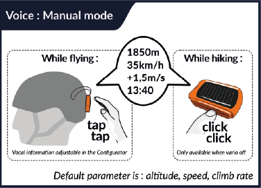
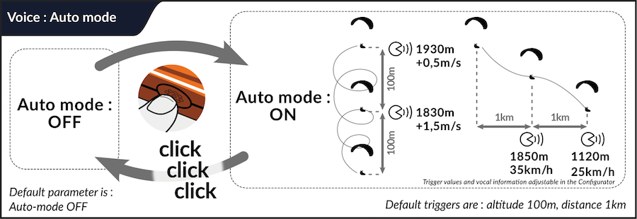
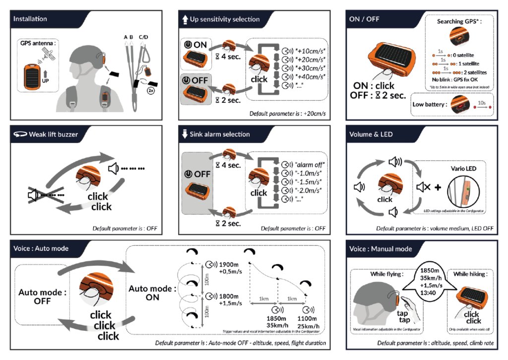
Puede activar o desactivar el modo de voz automático: anuncia la información de vuelo cuando se cumplen las condiciones de distancia, altitud o tiempo.
Información de vuelo por voz :
- Velocidad GPS sobre el terreno (si está disponible)
- Altitud (ASL), calibrada a partir del GPS en la puesta en marcha, barométrica durante el vuelo
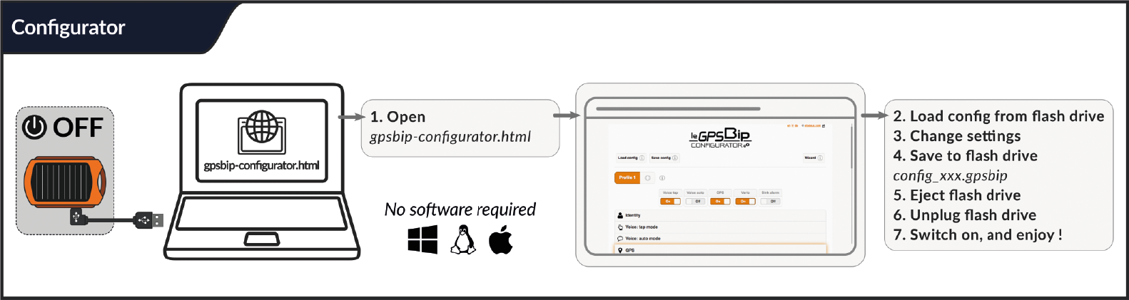

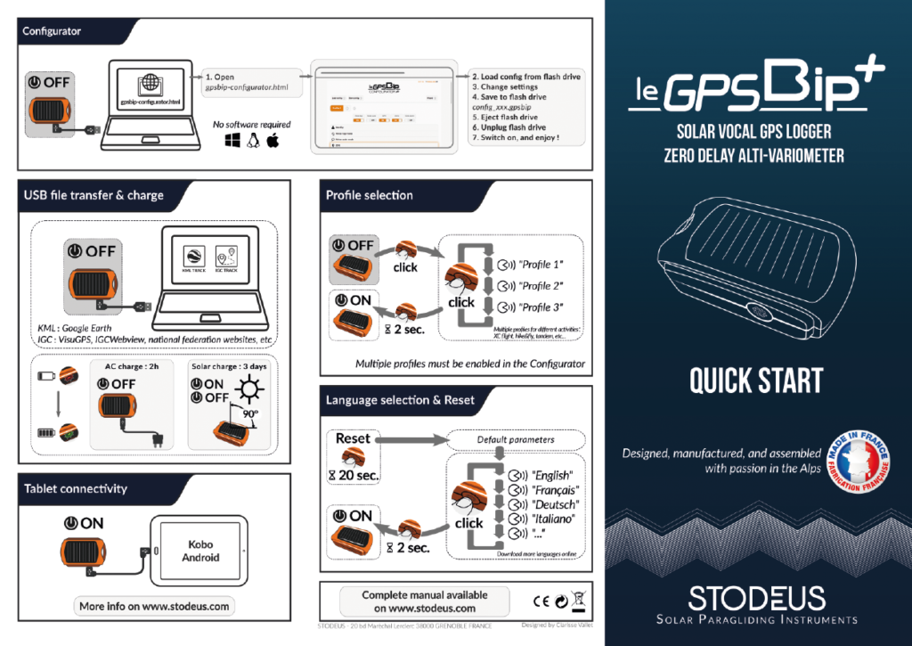
leGPSBip+ se puede conectar a cualquier Windows, Linux o Mac.
leGPSBip+ no debe de ninguna manera formatearse, ya que podría invalidar la garantía del fabricante.
Esto significa que hay que calibrar los sensores para poder beneficiarse del Vario Instant.
Gracias por siga el procedimiento descrito aquí.
Esto no se aplica al leGPSBip+, los sensores están calibrados de fábrica, e Instant Vario está activado por defecto.
No es posible forzar una nueva calibración. De hecho, no es necesario volver a hacerlo (ni siquiera después de una actualización o un reinicio). Cuando se ha hecho la primera vez, si se ha validado (confirmación vocal), entonces los sensores están correcta y definitivamente calibrados. Si no se hubieran calibrado correctamente, entonces la calibración habría fallado y el proceso se habría reiniciado hasta que se validara la calibración.
- Descargar el archivo del paquete de idioma
- Conecte el leGPSBip+ al USB (consulte la sección "transferencia de archivos y carga" del manual) a un ordenador
- Sustituye el archivo antiguo por el nuevo en la carpeta "voices".
- Deja conectado el leGPSBip+ hasta que deje de parpadear y haz clic en "Expulsar".
- Desconecte el leGPSBip+ y enciéndalo
Siempre debe haber al menos un paquete de idiomas en la carpeta "voices".

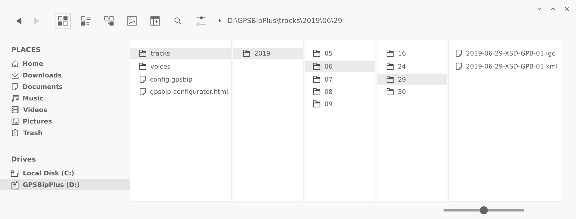
Cuando conectes tu GPSBip+ al ordenador, aparecerá como una memoria USB en el explorador de archivos.
Su árbol raíz debe ser el siguiente: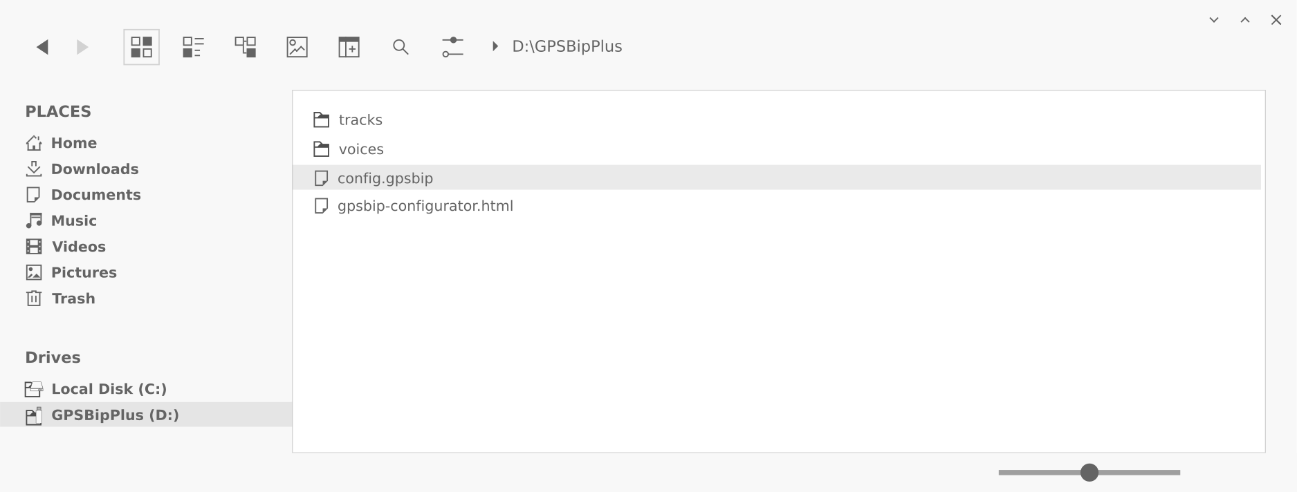
Si se borra la carpeta "voices" o el archivo "gpsbip-configurator.html", el dispositivo dejará de funcionar correctamente. Tampoco se les debe cambiar el nombre. Y el disco leGPSBip+ no debe formatearse bajo ningún concepto, ya que esto anularía la garantía del fabricante.
Sólo se puede borrar el archivo "config.gpsbip", esto equivale a realizar un reset (pulsar el botón durante 20s).
La carpeta "voices" debe contener siempre al menos un paquete de idiomas. Puedes eliminar los paquetes de idioma que no utilices. Si un paquete de idioma se coloca fuera de la carpeta "voices", no funcionará.
La carpeta "pistas" contiene las pistas grabadas. Están ordenadas por fecha o plano.
Los archivos de seguimiento y las carpetas de fechas pueden eliminarse si es necesario.
- Apagar el aparato
- Conéctalo a un ordenador mediante USB
- Abra el Configurator
- Haga clic en "Cargar configuración" y siga las instrucciones.
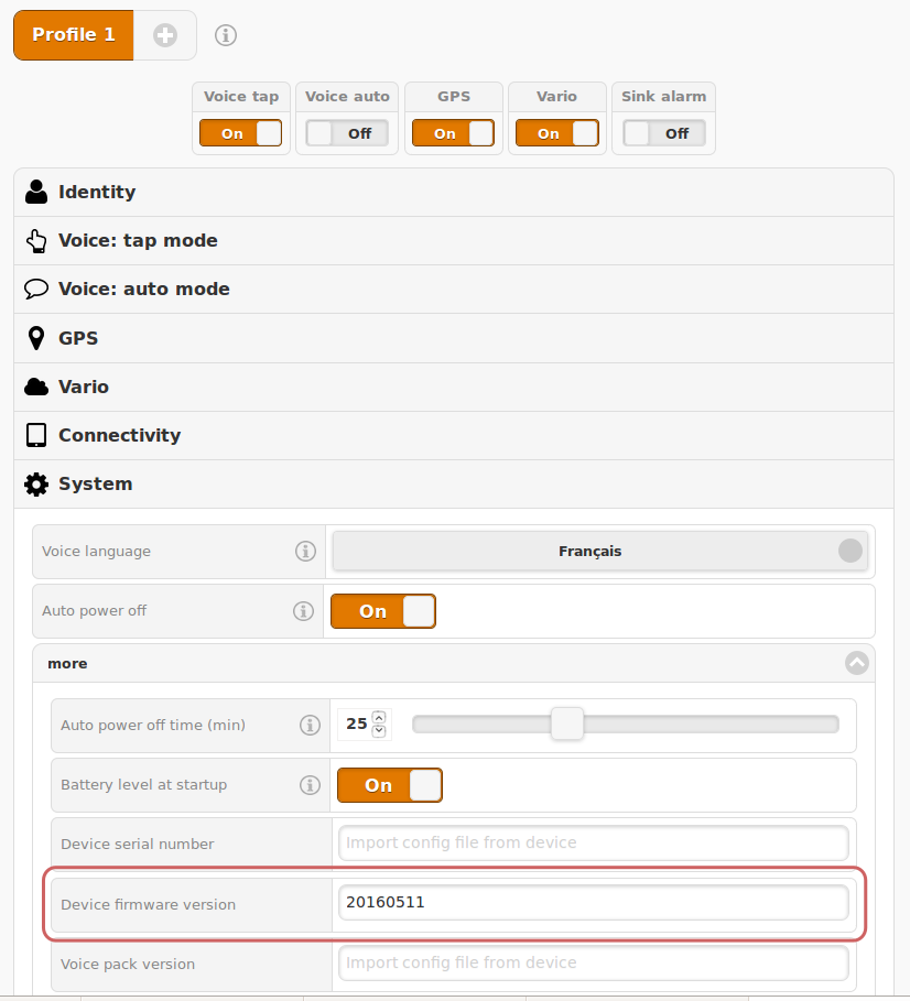
- El número de versión será visible en Sistema > más (véase la captura de pantalla siguiente)